Parcel data is a type of geographic information system (GIS) data that contains information about parcels of land. Parcel data is typically collected by local governments and includes information such as parcel boundaries, ownership, zoning, tax assessments, and other related data. This type of data can be used for a variety of purposes such as real estate research, property assessment, zoning analysis, and more. Parcel data can be obtained from local government offices or through online GIS portals. The type of information available in parcel data varies depending on the jurisdiction and the source. Generally, parcel data includes: parcel boundaries, owner name and address, zoning designations, tax assessments, land use designations, aerial photos or satellite images, deed records and more.
Who uses parcel data? Parcel data is used by a wide variety of people and organizations. The following groups use parcel data for planning, development, and government purposes:
- Planners use parcel data to develop plans and identify opportunities for growth and redevelopment. They can also use parcel data to help them guide future growth and development, plan for infrastructure and transportation needs, and manage the impacts of future growth on the environment. Planners may also use parcel data to help them plan for emergency response in areas prone to natural disasters. parcel data is used by a wide variety of people and organizations.
- Developers use parcel data to determine the feasibility of building a new development project or adding onto an existing one. They can also use it to find out about nearby infrastructure such as roads, water, sewer lines, schools, recreation facilities, and other public services.
- Local governments use parcel data to assess property taxes and to perform other services for their communities. They may also use this information to help them prepare for emergency response in areas prone to natural disasters.
- Businesses can use parcel data to find out about potential customers in the area or even find potential new employees. For example, parcel data can help a business find out which neighborhoods have the highest income levels or the most families with school-aged children. In addition, businesses can use parcel data to help them make decisions about where they should locate a new store or other type of business or service offering.
- Environmental groups may use parcel data to find out where there are sensitive environmental areas such as wetlands or floodplains that might be impacted by a proposed development project. In addition, they can also use it to determine where there are natural resources that could be damaged by a proposed development project (for example, watersheds).
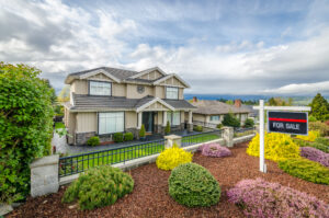
- Individuals interested in finding out about their community may also use parcel data for personal reasons (for example, if they are thinking about buying a home).
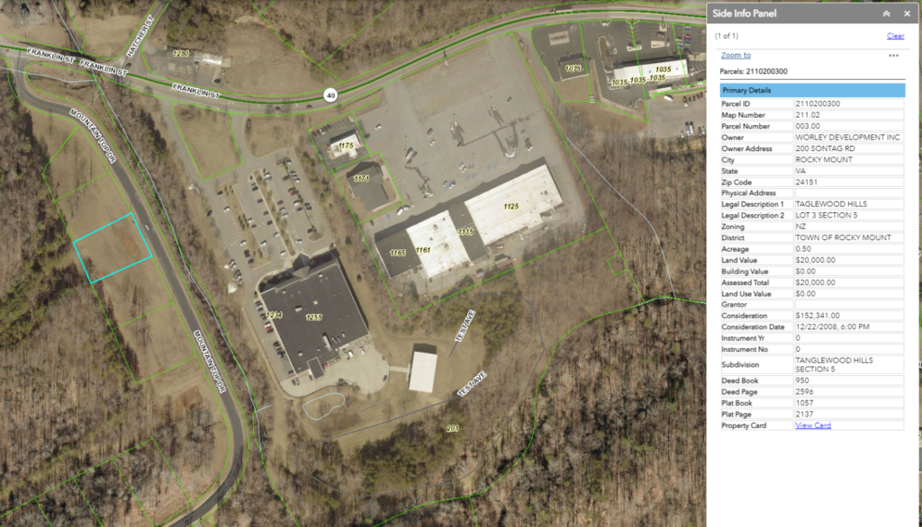
What is a parcel number? A parcel number, also known as a bulk data field, is a unique identifier used to identify a specific piece of property. It is typically used by local governments and other organizations to keep track of the ownership and boundaries of properties. Parcel numbers are typically composed of a combination of letters and numbers that represent the geographic location of the property, such as the county, city, or township. They can also be used to access information about the property, such as its size, zoning status, and tax history. Parcel numbers can be used to access detailed information about the property at a more granular level than traditional street addresses. This can allow for more accurate mapping of property boundaries and can help in managing land use at a local level.
What Information Is Not Available? The physical characteristics of parcels that are not available for display on the Parcel Data viewer include: Parcel boundaries for parcels that are not shown as part of a larger parcel Parcels that have no legal description Parcels that have been identified as exempt from property taxation (e.g. government land, non-profit land, etc.) Parcels that have been identified as exempt from property assessment (e.g. agricultural land) Parcels that have been identified as exempt from the requirement to file an annual statement of assessment (e.g. certain types of property owned by non-profit organizations) Parcels that are owned by the State of Minnesota and managed by a state agency Parcels that are owned by a county, city or town and managed by a local government entity or utility.
How do I get and use parcel data? Ageon provides comprehensive parcel data that includes information about the location, size, and ownership of each parcel. We collect data from various sources such as government agencies, county records, and proprietary databases. Our team of experts verifies and updates the data regularly to ensure accuracy and reliability. The parcel data we offer can be integrated into various business applications such as Geographic Information Systems (GIS), Customer Relationship Management (CRM) software, and property management systems. This integration enables businesses to access parcel data seamlessly and use it to make critical decisions. Simply submit a contact us form or send us an email to get started. Once you’ve got the data, we continue to work with you to make sure you get the most out of it.